


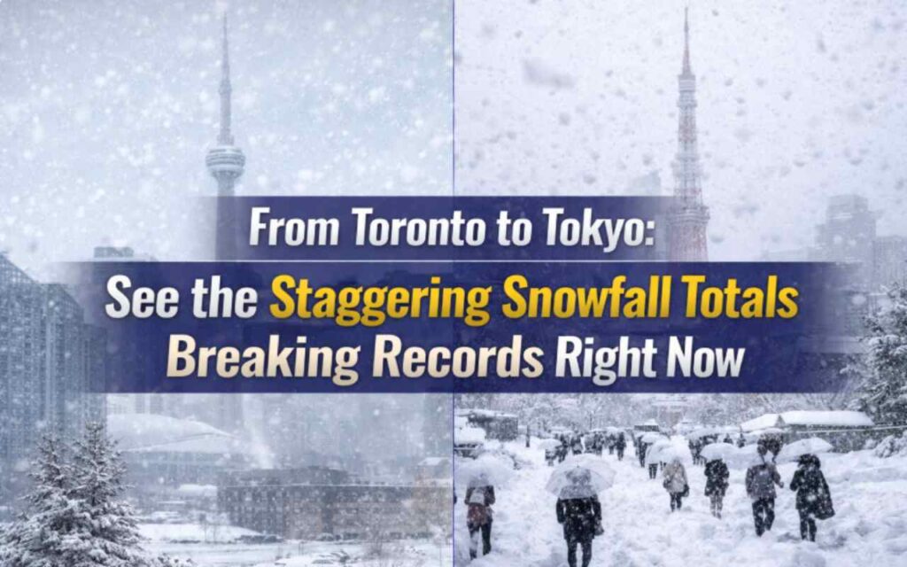
From Toronto to Tokyo: See the Staggering Snowfall Totals Breaking Records Right Now. As January 2026 draws to a close, a massive winter storm system has carved a path of frozen disruption across the Northern Hemisphere, leaving meteorologists stunned and millions of citizens digging out from unprecedented accumulation. From the bustling streets of Toronto to the typically milder regions of the US Northeast, and stretching all the way to the Russian Far East, the last 72 hours have rewritten the weather history books.
This was not just another winter storm. It was a “perfect storm” of atmospheric river moisture colliding with an entrenched Arctic polar vortex, creating snowfall rates that overwhelmed municipal infrastructure and grounded air travel globally.
For readers of Legal News Updates, this event brings not just weather stats but significant questions regarding municipal liability, “Force Majeure” clauses in contracts, and homeowner obligations for snow removal.
North America Buried: The Northeast and Canada Crisis
The most immediate impact has been felt across the North American eastern seaboard and the Great Lakes region. A powerful low-pressure system, which bombed out (underwent “bombogenesis”) over the Great Lakes, dumped historic volumes of snow in a matter of hours.
Toronto’s 60-Centimeter Paralysis Perhaps the most shocking headline comes from Toronto, Canada. On January 27, 2026, the city recorded nearly 60 cm (approx. 24 inches) of snow in a single day. This accumulation shattered previous daily records, effectively shutting down the 401 highway—North America’s busiest freeway—and leaving thousands of vehicles stranded.
The US Northeast Impact Across the border, the system lashed New York, Pennsylvania, and New England.
-
Buffalo & Western NY: Saw lake-effect enhancement pushing totals over 30 inches in localized bands.
-
New York City & Philadelphia: Finally broke their “snow drought” with a significant heavy wet snow event, dropping 12–15 inches in Central Park, causing delays for millions of commuters.
-
The Midwest: Earlier in the week, Kansas and Missouri saw blizzard conditions with wind gusts topping 50 mph, creating whiteout conditions that shut down Interstate 70.
Global Extremes: The 6-Foot Snowfall in Russia
While North America struggled with two feet of snow, a truly terrifying weather event unfolded simultaneously in the Russian Far East. The Kamchatka Peninsula reported a staggering 1.8 meters (nearly 6 feet) of snow falling in under 48 hours.
This extreme event was fueled by a rare tropical moisture plume surging north from the Pacific, crashing into the Siberian High. Images from the region show cars completely buried, with residents digging tunnels from their front doors to the street. It serves as a stark reminder of the increasing volatility of global weather patterns in 2026.
By The Numbers: Breaking Down the Accumulation
The following table highlights the preliminary snowfall totals reported by the National Weather Service and Environment Canada for the January 26–28, 2026 storm system.
The “Zero Visibility” Factor: Why This Storm Was Different
Meteorologists point to the Snow-to-Liquid Ratio as the key factor in this week’s chaos. Typically, snow falls at a ratio of 10:1 (10 inches of snow for every 1 inch of water). However, the arctic air present in this system created a ratio closer to 15:1 or 20:1 in the Midwest.
This resulted in “fluffy,” powdery snow that is easily blown by the wind. Even areas that received only 6 inches of snow faced ground blizzard conditions, where visibility was reduced to zero not by falling snow, but by existing snow being whipped up by 50 mph winds.
Legal Angles: Your Rights in a Winter Emergency
As a legal news platform, it is critical to address the liabilities that arise during such historic weather events.
1. The “24-Hour” Sidewalk Rule In most US and Canadian cities (like NYC, Chicago, and Toronto), property owners have a strict window—usually 4 to 12 hours after snowfall stops—to clear their sidewalks.
-
The Risk: Failure to clear ice/snow can lead to “Slip and Fall” lawsuits. With 2 feet of snow, the “Reasonableness Standard” comes into play. Courts may be lenient if the city itself hasn’t plowed the streets, but once the roads are clear, homeowners are expected to act.
2. Employment & “Act of God” Can you be fired for missing work due to the storm?
-
At-Will Employment: In the US, generally yes. There is no federal law protecting employees from being fired for missing work due to weather.
-
Exceptions: If a “State of Emergency” is declared that legally bans travel (as seen in parts of Western NY this week), an employer mandating you to come in could be liable for negligence if you are injured.
3. Flight Cancellations & Refunds With over 5,000 flights canceled this week:
-
US DOT Rules: If the airline cancels the flight (even due to weather), you are entitled to a full cash refund if you choose not to travel. You are not required to accept a voucher.
Climate Context: Is This the New Normal?
Climate scientists have long warned that a warming atmosphere holds more moisture—approximately 7% more for every degree Celsius of warming. When this moisture-laden air meets a cold snap, the result is not less snow, but more intense bursts of snowfall.
The January 2026 storms fit this model perfectly: warmer oceans fueling massive moisture plumes that dump record-breaking precipitation once they hit freezing air over land. As clean-up crews work around the clock from Pennsylvania to Ontario, the data suggests these “megastorms” may become a staple of the mid-2020s winters.
Conclusion: Digging Out and Looking Ahead
As the system moves out into the Atlantic, the immediate danger has passed, but the freezing temperatures remaining in its wake pose a new threat: Flash Freezing. The wet slush from the heavy storm is expected to turn into solid ice sheets tonight, creating treacherous conditions for the morning commute.
For now, the records set in January 2026 will stand as a benchmark for severe winter weather, reminding us of nature’s capacity to grind modern life to a halt in a matter of hours.